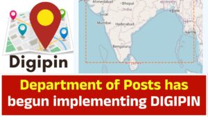
The Department of Posts has begun implementing DIGIPIN across its digital infrastructure, including rural regions:
- Madikeri (Kodagu, Karnataka) recently upgraded to “IT 2.0” systems, with postal staff equipped for real-time tracking via a new mobile app. As part of this initiative, DIGIPIN was introduced to ensure precise last-mile delivery (zeebiz.com, indiapost.gov.in, timesofindia.indiatimes.com).
- Nationwide launch of the “Know Your DIGIPIN” and “Know Your PIN Code” portals on May 27, 2025. These platforms allow users to retrieve both traditional PIN codes and exact 4 m×4 m grid-level DIGIPINs via geolocation or coordinate input (m.economictimes.com).
Technical Foundations & Open Source Development
- The official technical document (March 2025) outlines how DIGIPIN divides India into uniform 4 × 4 m grid cells over increasingly granular levels, generating a 10-character alphanumeric code purely from latitude and longitude. No personal data is stored (indiapost.gov.in).
- The full encoding logic is public and open-source, with code available through GitHub (CEPT‑VZG/digipin). The repository includes a RESTful Node.js API with endpoints for encoding and decoding coordinates (github.com).
- DIGIPIN’s hierarchical encoding utilizes a 16-symbol alphabet (2‑9, C, F, J, K, L, M, P, T). Each character refines the location’s granularity, narrowing from ~1,000 km region (first character) down to ~3.8 m cell (10th character) (linkedin.com).
Developer Integration
- A helpful Dart library supports DIGIPIN encoding/decoding, enabling Flutter apps to integrate it easily (pub.dev).
- Tools like OpenCage are already returning DIGIPIN codes in their geocoding APIs for Indian locations (blog.opencagedata.com).
- Developers can build custom services using CEPT’s:
GET /api/digipin/encode?latitude=...&longitude=...→ returns DIGIPINGET /api/digipin/decode?digipin=...→ returns center-point coordinates (github.com)
Use Cases & Benefits
Deliveries & Logistics
Precision down to ~4 m enhances e-commerce, logistics, and postal deliveries—especially in remote, rural, or unstructured areas (indiapost.gov.in).
Emergency Response
Emergency services can pinpoint locations even in dense forests, rural villages, or at sea without relying on descriptive addresses (indiapost.gov.in).
Government & Finance
The system boosts service delivery, KYC accuracy, and GIS-based planning for urban/rural governance (m.economictimes.com).
Tech Ecosystem
With open API support, DIGIPIN becomes a digital infrastructure layer—fitting India’s National Geospatial Policy 2022 and evolving towards “Address-as-a-Service” (indiapost.gov.in).
What’s Next?
- Mobile app launch: Government is preparing standalone apps for generating and decoding DIGIPIN beyond the web portal (indiapost.gov.in).
- Broader integration: Expect DIGIPIN to be used in BFSI, fintech, e-commerce, logistics, and emergency services as adoption grows (ndtv.com).
- Federated Digital Address (DHRUVA): DIGIPIN is the foundational “Digital Address Layer” for DHRUVA—a federated digital public infrastructure designed for interoperability across government and private systems (indiapost.gov.in).
Summary
DIGIPIN is now live nationwide and is being actively rolled out via postal modernization programs. It’s built on a robust, open-source, hierarchically encoded 10-character alphanumeric grid. Developers across platforms—web, mobile, GIS—can integrate it seamlessly using public APIs and libraries. It stands to revolutionize delivery, emergency response, GIS planning, financial onboarding, and more.