Historically, Karnataka’s land records were maintained manually through handwritten registers and physical maps stored in revenue offices. This decentralized system was labor intensive, prone to errors, and limited public access, often leading to disputes and fraud.
Transition to Digital:
With rapid urbanization and increasing real estate transactions, the state initiated digitization projects in the early 2000s. The government’s efforts culminated in the development of a centralized digital platform—the Bhoomi portal—designed to automate data entry, digitize archival documents, and streamline land record management.
Impact on Governance:
The shift improved transparency, efficiency, and accessibility of land records, significantly benefiting rural development and reducing bureaucratic delays. It also laid the groundwork for modernizing legal and administrative processes.
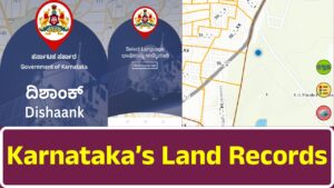
2. Overview of the Bhoomi Portal
Purpose and Functionality:
The Bhoomi portal serves as the official online interface for accessing Karnataka’s land records. It provides:
- Land Ownership Details: Users can verify property ownership, view historical changes, and retrieve metadata about land classification.
- Mutation Records: The system supports online applications for updating ownership after transactions, including submission of legal documents and fee payments.
- Survey Maps and Measurement Data: Detailed, interactive maps based on professional surveys help users understand property boundaries.
- Revenue and Tax Information: Citizens can access historical and current revenue records, track tax liabilities, and review payment histories.
User Experience:
Designed for ease of use, the portal offers a dashboard with intuitive search tools, multi-language support, and integrated help features to guide users through various processes.
Security Measures:
Robust security protocols—including secure authentication, encryption, and audit trails—ensure data integrity and protect sensitive information.
3. Detailed Functionalities
Ownership Verification:
The portal allows users to locate land records by entering parameters such as district, taluk, and survey numbers. It displays the registered owner’s details, historical ownership data, and associated metadata, which helps reduce fraud and resolve disputes.
Mutation Process:
Digital mutation facilitates the update of records after property transactions. The online process includes:
- Filling out application forms
- Uploading legal documents
- Making fee payments online
- Tracking application progress in real time
Survey and Map Access:
Interactive survey maps provide users with precise geographical data, including:
- Detailed property boundaries
- Integration with GIS for overlaying additional information (e.g., terrain and infrastructure)
- Options to zoom, overlay, download, and print maps
Revenue and Taxation:
Accurate land revenue records are crucial for tax assessments. The portal offers:
- Historical revenue data and current tax liabilities
- Payment histories for auditing and dispute resolution
- Automated integration with financial systems for real-time updates
4. Administrative and Legal Framework
Legislative Support:
The transformation of land records has been backed by legislative reforms that:
- Amend land revenue laws to recognize digital records and electronic signatures
- Standardize the mutation process with clear guidelines and documentation requirements
- Strengthen data protection laws to safeguard personal information
Roles of Local Bodies:
Local revenue offices and district bodies work in tandem with state departments to:
- Ensure accurate and timely updates to the centralized database
- Provide support and training to officials
- Resolve disputes through judicial oversight, with courts increasingly relying on digital records as evidence
Standard Operating Procedures:
SOPs cover data entry, mutation processing, periodic audits, and dispute resolution, ensuring uniformity and transparency across all administrative levels.
5. Technological Infrastructure and Innovations
Database Management:
The Bhoomi portal relies on a centralized database with features like:
- Real-time data updates and synchronization across all regions
- Robust backup systems and data redundancy measures
- Scalability to handle increasing volumes of records and user queries
Software and Web Technologies:
Modern web design principles make the portal accessible across devices. Key technological aspects include:
- Responsive user interfaces for desktop and mobile access
- Advanced search algorithms and interactive mapping tools
- Secure protocols (HTTPS, multi-factor authentication) to protect data
Data Integration:
Interoperability with other governmental databases enhances the reliability of land records. This integration supports:
- Cross-departmental data sharing and real-time synchronization
- Linkages with national land resources and urban planning systems
Emerging Technologies:
Future enhancements include:
- Exploring blockchain for immutable record-keeping
- Incorporating artificial intelligence for anomaly detection and process automation
- Migrating to cloud-based systems for better scalability and security
6. Socio-Economic Impacts
Transparency and Fraud Reduction:
Digitizing land records has:
- Reduced opportunities for fraudulent alterations
- Increased accountability among government officials through audit trails
- Empowered citizens by providing direct access to verified information
Economic Efficiency:
The online system has:
- Lowered transaction costs by eliminating physical visits to revenue offices
- Streamlined revenue collection through automated tax assessments and online payment gateways
- Boosted confidence in the real estate market, fostering economic growth
Community Empowerment:
Both rural and urban populations benefit from improved accessibility:
- Rural residents gain easier access to government schemes and legal support
- Urban planners and developers can make informed decisions based on accurate land use data
- Marginalized groups are better able to assert their property rights, contributing to social equity
7. Challenges and Limitations
Data Quality Issues:
Challenges include:
- Integrating legacy data with modern digital records
- Correcting errors introduced during manual data entry
- Reconciling fragmented records from different administrative regions
Technical and Infrastructure Hurdles:
Some limitations are:
- Inconsistent internet connectivity in remote areas affecting access
- Occasional system downtimes and hardware constraints at local offices
- The need for ongoing training to keep up with technological advancements
User Literacy and Bureaucratic Barriers:
Digital literacy remains a barrier for some citizens, particularly in rural areas. Additionally:
- Language barriers and entrenched bureaucratic practices can slow down processes
- Legal discrepancies between old paper records and new digital records sometimes lead to disputes
8. Future Directions and Prospects
Technological Enhancements:
The government is focusing on:
- Integrating emerging technologies like blockchain, AI, and cloud computing
- Further improving user interfaces and expanding mobile accessibility
Policy Reforms:
Ongoing efforts aim to:
- Streamline legal processes and reduce bureaucratic delays
- Enhance data protection laws and ensure continuous improvement through regular audits
- Facilitate better coordination among various government departments
Community Outreach and Digital Literacy:
To maximize the portal’s impact, initiatives include:
- Training programs and localized support centers to improve digital literacy
- Public awareness campaigns to educate citizens on the benefits and usage of the digital system
- Feedback mechanisms to incorporate user suggestions into future updates
Expansion and Integration:
Looking ahead, the system may expand to include:
- Advanced modules for land use planning and real estate market analytics
- Broader data sharing with other states and national systems, setting a standard for digital land records across India
9. Comparative Analysis
Global and National Benchmarks:
Karnataka’s system is frequently compared with both global standards and other Indian states:
- It is noted for its efficiency, transparency, and robust legal backing.
- Lessons from other jurisdictions have been incorporated to enhance system functionality and user experience.
- Continuous improvements and adaptability ensure that the Bhoomi portal remains a leading example of digital governance.
10. Conclusion
The digital transformation of Karnataka’s land records system through the Bhoomi portal represents a significant milestone in modernizing public administration. It has:
- Streamlined property transactions and reduced bureaucratic delays
- Enhanced transparency and accountability in land management
- Provided economic benefits by fostering a secure and efficient real estate market
- Empowered citizens by ensuring that land records are accessible, accurate, and legally robust
While challenges remain—such as integrating legacy data, ensuring consistent access in remote areas, and enhancing digital literacy—the ongoing technological innovations and policy reforms promise a future where land records are even more reliable and user-friendly. The system stands as a model for digital governance, with potential applications and expansions that could influence similar initiatives both across India and internationally.
This summary encapsulates the key themes and insights from the original 9000-word report, providing an overview of the evolution, functionality, impact, and future prospects of Karnataka’s land records system.