Mappls India : ಗೂಗಲ್ ಮ್ಯಾಪ್ ಬೇಡ ಈ ಹೊಸ Mappls App ಬಳಸಿ 3D ರಸ್ತೆ ಕಣ್ಣುತ್ತೇ ಟ್ರಾಫಿಕ್ ಎಲ್ಲಿದೆ ಅಂತ ಗೊತ್ತು ಆಗುತ್ತೆ
1. Introduction
Mappls, the digital mapping platform developed by MapmyIndia, is one of the most advanced indigenous navigation tools in India. In a country where accurate and localized navigation is crucial, Mappls has emerged as a key player that combines detailed digital maps, real-time traffic updates, and government-supported data solutions. This article explores everything you need to know about Mappls, its unique offerings, and how it’s transforming navigation across sectors.
2. The Evolution of MapmyIndia
MapmyIndia was founded in 1995 by Rakesh Verma and Rashmi Verma, with a vision to build India’s first digital mapping platform. Initially serving the corporate sector, MapmyIndia expanded rapidly as technology evolved. Its maps were first used for logistics, fleet management, and vehicle tracking.
Key milestones:
- 2004: First digital map for India launched.
- 2010: Consumer-facing apps started emerging.
- 2021: Launch of Mappls, a free and independent navigation alternative.
3. Launch of Mappls
Mappls was launched as a part of MapmyIndia’s broader consumer strategy to offer digital maps, navigation, live traffic updates, and geospatial services for individual users, businesses, and government.
The name “Mappls” stands for “Maps + Plus” – indicating that it’s more than just a map. It includes:
- Navigation
- Safety alerts
- House number-level accuracy
- Street imagery
- EV station locators
- Pollution levels
4. Features of Mappls
Mappls brings a host of innovative features:
4.1 House Number-Level Mapping
Detailed mapping of over 7.5 crore addresses, including house numbers – something not even Google Maps provides in many Indian cities.
4.2 Real-Time Traffic Updates
Get updates on:
- Traffic congestion
- Road closures
- Accidents
- Construction work
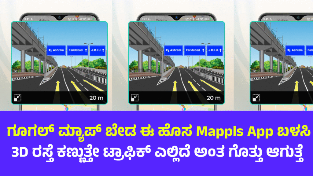
4.3 3D Landmark View
Realistic 3D models of famous buildings and landmarks enhance urban navigation.
4.4 Live View & Video Maps
Users can explore street-level video maps for better navigation insights.
4.5 Mappls PIN
A unique 6-character alphanumeric digital address (like “8G2TQC”) helps identify precise locations.
4.6 Navigation for EV Owners
EV charging station locator with real-time availability status.
4.7 Offline Maps
Use maps even without internet connection – a big advantage for rural and remote areas.
5. How Mappls Differs from Google Maps
| Feature | Mappls | Google Maps |
|---|---|---|
| Offline Maps | Fully offline, India-centric | Partial offline support |
| Map Accuracy | High, Indianized addresses | Good, but generalized |
| Mappls PIN | Unique short digital address | No such feature |
| Government Support | Endorsed by Indian Govt. | Foreign entity |
| Data Privacy | No data sold to advertisers | Ad-based model |
Mappls is considered more privacy-focused and India-centric.
6. Use Cases: Individual and Enterprise
6.1 For Individual Users
- Daily navigation
- Commute planning
- EV station location
- Tracking family/friends
6.2 For Businesses
- Delivery route optimization
- Fleet tracking
- Customer address verification
- Real-time traffic analysis
Companies like Flipkart, Amazon, Ola, and SBI use MapmyIndia services.
7. Mappls for Government and Smart Cities
Mappls supports over 100 smart city projects, helping authorities with:
- Urban planning
- Traffic management
- Disaster response
- Utility mapping
- Surveillance integration
Example: Lucknow Smart City uses Mappls for civic monitoring and city dashboards.
8. Mappls APIs and SDKs
MapmyIndia offers over 300+ APIs for developers:
- Maps API
- Routing API
- Geocoding & Reverse Geocoding
- Weather & Pollution API
- EV Station API
- Navigation SDK for Android/iOS
These APIs are used in:
- Banking (e.g., customer verification)
- Logistics (route planning)
- E-commerce (address accuracy)
9. Privacy and Data Security
Mappls emphasizes data sovereignty:
- Data hosted in India
- No sale to advertisers
- GDPR-compliant
- No user profiling or ad-tracking
This makes it attractive for privacy-conscious users.
10. Technological Backbone
Mappls uses:
- AI and Machine Learning: For traffic predictions, road insights
- IoT Integration: For smart vehicle navigation
- Drone and Satellite Imagery: For high-definition 3D mapping
- Crowdsourcing: Real-time updates from users and partners
Its map database includes:
- 7.5 crore+ addresses
- 1 crore+ points of interest
- 14 lakh+ kms of road network
11. Integration with Vehicles and IoT
MapmyIndia has partnered with major automobile brands like:
- Tata Motors
- MG Motor
- Hyundai
- Mahindra
In-built dashboards offer:
- Live navigation
- Vehicle tracking
- Fuel alerts
- Crash detection
- Over-speeding alerts
12. Mappls App Overview
Key Tabs:
- Search: Find places, PINs, addresses
- Navigate: Real-time routing with traffic info
- Explore: POIs nearby
- Live Feed: Dashcam-like video maps
- MapMyIndia Move: Personal tracking app
Available on Android & iOS for free.
13. Contribution to “Digital India”
Mappls aligns with initiatives like:
- Atmanirbhar Bharat
- Digital India
- Gati Shakti
- Smart Cities Mission
It supports Make-in-India efforts by reducing dependency on foreign tech.
14. Challenges Faced
Despite its innovations, Mappls has faced:
- Low brand awareness compared to Google Maps
- Dependency on smartphone usage
- Need for continual map updates
- Limited international coverage
However, its India-first strategy has given it a growing loyal user base.
15. Competitors in the Market
Main competitors include:
- Google Maps
- HERE Technologies
- TomTom
- Waze
- ISRO’s Bhuvan platform (for government use)
Despite competition, Mappls remains the only Indian company offering full-stack navigation and mapping solutions.
16. Future Roadmap
MapmyIndia aims to:
- Add AI-powered predictive maps
- Expand 3D video map coverage
- Introduce augmented reality navigation
- Build partnerships with international carmakers
- Integrate with UAVs/drones for logistics
It is also expanding to BharatNet, AgriTech, and healthcare mapping.
17. FAQs
Q1. Is Mappls free to use?
Yes, the app and navigation services are free for individual users.
Q2. How can I get a Mappls PIN for my address?
You can generate it via the app or website by entering your house/location details.
Q3. Can I use Mappls offline?
Yes, you can download maps for offline navigation.
Q4. Is Mappls better than Google Maps?
For India-specific needs, yes – it offers deeper accuracy and more features tailored to Indian users.
Q5. Who owns Mappls?
Mappls is a platform by MapmyIndia, an Indian company listed on the NSE/BSE.
18. Conclusion
Mappls by MapmyIndia is not just a navigation tool – it is a comprehensive geospatial intelligence platform. From empowering commuters to revolutionizing logistics and aiding government planning, Mappls is shaping India’s digital landscape. It’s not just about maps; it’s about making every place and every route in India smarter, more accessible, and more secure.
In an era where data privacy, localization, and real-time intelligence are paramount, Mappls is India’s answer to global tech giants. As it continues to evolve, it promises to be the foundation for India’s smart mobility future.